
Return to Book 13
The Jesuits and French Colonisation 1524-1699
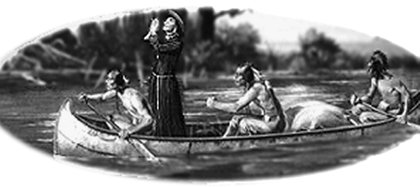
After the original French voyagers colonized southern Canada and the Great Lakes, French Jesuits came to North America to try to spread Christianity among the Hurons by preaching and building churches. During this time, French Huguenots established self-governing colonies beyond the control of their French state. Huguenot refugees founded New Paltz, New York in the 1660s as part of a large Huguenot migration to the primarily Dutch New Netherland. These Huguenots, led by Louis Dubois, formed an early self-governing unit called the duzine and made treaties with the local Native Americans to purchase land from the Hudson River to the mountains. ‘New France’ continued to expand south and west to discover the Mississippi River. They continued to explore south via the Mississippi River but turned back due to concerns that they were getting too close to the Spanish settlements. Other French explorers claimed the Mississippi Valley and Great Plains for France and began building trading posts their in 1682. The French founded the colony of Louisiana in 1699 after Saint Louis (established in 1684 in Texas) was raided by Indians and the last of the settlers were killed.
With thanks to Timeline for the above narrative.
An Accurate Depiction of New France, 1657
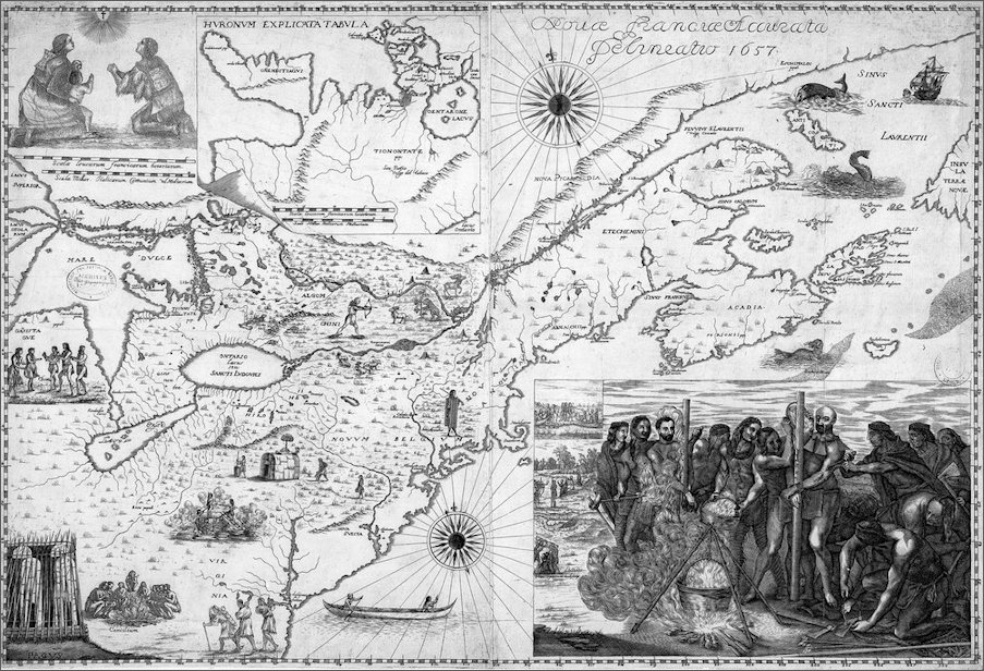
This 1657 map, entitled Novae Franciae Accurata Delineatio (An accurate depiction of New France), is attributed to the Jesuit Francesco Bressani (1612−72), who was sent as a missionary to the Huron Indians in 1642.
In 1653 he published in his native Italy an account of his stay in New France in which he announced the impending publication of a map, also based on his time in North America. The map shown here, from the National Library of France, is one of only two known copies of Bressani's map. It represents the Great Lakes region with remarkable accuracy. An inset map at the top center shows the Huron country. The map also contains illustrations related to Bressani's mission and intended for the edification of the faithful. In the lower right is a scene of the martyrdom in 1649 of priests Jean de Brébeuf and Gabriel Lalemant. In the upper left is a portrait of an Indian family in prayer. Illustrations on the map depict Indian villages, a canoe, animals and hunting, and other scenes. The Dutch and English colonies of New Amsterdam and New England are indicated by their Latin names, Novum Belgium and Nova Anglia. Scale is given in French leagues and Italian miles. The map is from the collection of the geographer Jean-Baptiste Bourguignon d'Anville (1697–1782). It was given to King Louis XVI in 1782 and deposited in the National Library of France in 1924. Source : World Digital Library
Return to Top / Angelique Home Page / Home Page
Page refreshed : 6th May 2020 (G)